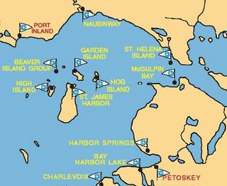
Beaver Island Group
Our first stop was Saint James Harbor in the Beaver Island Group. Tim, Baley and I met our newest bestest buddy, Jeff R., there. The four of us traveled the next week together in our powersailors. Jeff has a beautiful Oden called Sea Scape.

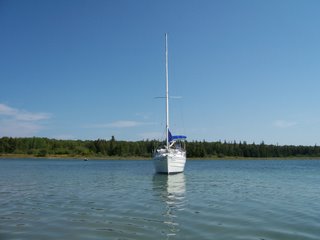
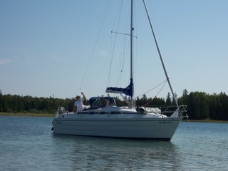
Jeff on Sea Scape at Charlevoix
Saint James Harbor is a quaint community. We rented bikes and toured the island. We also traveled to nearby Garden Island for a hike.
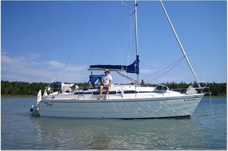
Jeff at Garden Island

Baley at Garden Island

Jeff on Sea Scape at Charlevoix
Saint James Harbor is a quaint community. We rented bikes and toured the island. We also traveled to nearby Garden Island for a hike.

Jeff at Garden Island

Baley at Garden Island
Charlevoix


There is some interesting hobbit archetecture and beautiful boats in Charlevoix.
I almost got mowed down by a very large yacht under the draw bridge to Lake Charlevoix. My little dinky Mac was in his way. I had to look up about 5 stories to see the wayward captain.
Jeff R. keeps his Oden here. Lake Charlevoix is connected to Lake Michigan offering the best of sailing on both size lakes.
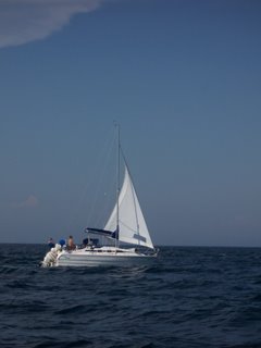
We had a great day sail out of Charlevoix on Lake Michigan.

Macinac Island

From Charlevoix it was to Macinac Island with a stop at Harbor Springs. We arrived at Macinac Island just before 2:00 on a Monday and were able to get a slip. We rented bikes and did the tourist thing.
Sometimes the little things are the most memorable. In this case, we rode our rented bikes around the island after dark. The Mac bridge lights are incredibly beautiful at night.
Les Cheneoux Island Region
From Macinac Island area, we cruised to the Les Cheneoux Island region. A waterway winds through the Les Chenoux Island region. The shores are lined with an abundance of nice cottages and boathouses. Old wooden boats are popular in the area. Even with slow winds, it makes a nice cruise since there is so much shoreline detail in a short distance. We were able to find a piece of beach along the channel to spend the night. We kept entertained watching the boats come and go along the channel. A public island, Government Island, is in the region. We anchored nearby and explored.
Detour Village and Harbor Island
From the Les Cheneoux region, we cruised up past Detour Village to Harbor Island. We made Harbor Island our base for a couple of days. On our most challenging afternoon, we ventured-out when the winds were exceptionally strong . What a ride - double reefed main and a storm jib and she was still trying to get away from us.
Points of Interest
The Beaver Island Group
History
The King of Beaver Island
Harbor Light
High Island and the High Island Israelites
High Island Map
King Benjamin of High Island
Ben ammased a 10 million fortune. Did he leave it on High Island for us to find?

Garden Island
Garden Island Map
ST. JAMES HARBOR (Beaver Island Group)
Location................... L 45° 44.6’ N; 085° 30.5’ W
From St. James to...
Mackinac Island 45 miles E
Rock Island Passage 65 miles SW
High Island 4 miles W
Manistique 33 miles NW
Vehicle Rental
Beaver Island Marina
Restaurants
St. James will be the hub for our islands cruising ground. If desired, Short day trips and return can be taken to the nearby islands. Anchorage is possible almost anywhere in the inner harbor. The privately owned Beaver Island Marine is at the north end of the harbor.
On shore, we could arrange a 30-mile bike or automobile trip around this island, seeing seven beautiful inland lakes, or take a walking or biking tour of the historic sites in and near the village of St. James. Car rentals are available. They're not the best cars but it might be fun to rent one. Rental bikes also available. There are some good places to eat within walking distance.
HOG ISLAND (Beaver Island Group)
From Hog Island to...
St. James Harbor 22 miles (approximately)
Hog Island's Fisherman Bay offers some good secluded anchorage. The bottom holds well and the water very clear. With careful observation you should be able to see all the rocks and shoals you should try to miss. We'd be protected there except from a strong west-northwest winds.
GARDEN ISLAND (Beaver Island Group)
Location ....................... L 45° 47.5 N; 085° 30 W
From Garden Island to...
St. James 5 miles south
High Island 8 miles southwest
Garden Island Harbor offers good shelter from all winds north through east to south. There is also shelter in some other shallow coves. This might be a nice place to anchor overnight.
HIGH ISLAND (Beaver Island Group)
Location.................... L 45° 45’ N; 085° 38’ W
From High Island to...
St. James 4 miles E
Rock Island 61 miles
There is a deep harbor on the northeast corner of High Island, protected from southwest through west to north winds. The harbor is really only a minor indentation in the shore. The prevailing winds are westerly. High Island Harbor would be a good day trip out of St. James or a stop over on the way to Rock Island.
History
The King of Beaver Island
Harbor Light
High Island and the High Island Israelites
High Island Map
King Benjamin of High Island
Ben ammased a 10 million fortune. Did he leave it on High Island for us to find?

Garden Island
Garden Island Map
ST. JAMES HARBOR (Beaver Island Group)
Location................... L 45° 44.6’ N; 085° 30.5’ W
From St. James to...
Vehicle Rental
Beaver Island Marina
Restaurants
St. James will be the hub for our islands cruising ground. If desired, Short day trips and return can be taken to the nearby islands. Anchorage is possible almost anywhere in the inner harbor. The privately owned Beaver Island Marine is at the north end of the harbor.
On shore, we could arrange a 30-mile bike or automobile trip around this island, seeing seven beautiful inland lakes, or take a walking or biking tour of the historic sites in and near the village of St. James. Car rentals are available. They're not the best cars but it might be fun to rent one. Rental bikes also available. There are some good places to eat within walking distance.
HOG ISLAND (Beaver Island Group)
From Hog Island to...
Hog Island's Fisherman Bay offers some good secluded anchorage. The bottom holds well and the water very clear. With careful observation you should be able to see all the rocks and shoals you should try to miss. We'd be protected there except from a strong west-northwest winds.
GARDEN ISLAND (Beaver Island Group)
Location ....................... L 45° 47.5 N; 085° 30 W
From Garden Island to...
Garden Island Harbor offers good shelter from all winds north through east to south. There is also shelter in some other shallow coves. This might be a nice place to anchor overnight.
HIGH ISLAND (Beaver Island Group)
Location.................... L 45° 45’ N; 085° 38’ W
From High Island to...
There is a deep harbor on the northeast corner of High Island, protected from southwest through west to north winds. The harbor is really only a minor indentation in the shore. The prevailing winds are westerly. High Island Harbor would be a good day trip out of St. James or a stop over on the way to Rock Island.
The end of an era.
Sailing adventures have occupied our summers for the last four years. We ventured to Isle Royale, Door County, The North Channel and finnally Northern Lake Michigan and Huron this year. It has been great fun and adventure but this year will be our last sailing summer. It is time to move on to other types of adventures.

